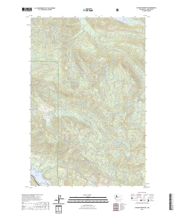
2023 Map of Cougar Mountain
USGS Topo · Published 2023About this map
Snoqualmie National Forest dominates this landscape in southeastern King County, where a complex network of forest roads facilitates access through the drainage basins of several major water systems. The northern portion of the map is defined by the Cedar River and Chester Morse Lake, while the southern reaches center on the North Fork Green River and the upper extent of the Howard A Hanson Reservoir. This geography highlights the critical role of these highlands in regional water management and conservation.
Find a feature on this map
51 named features on this map. Tap any name to fly to it.
Don’t see what you’re looking for? This feature index may not catch every label — zoom into the map to look around manually.
Map Details
Editions of this 2023 Cougar Mountain Map
This is the sole edition of this map. No revisions or reprints were ever made.
Other maps of this area

1913 · Cedar Lake
USGS Topo · 1:125,000

1953 · North Bend
USGS Topo · 1:24,000

1953 · Eagle Gorge
USGS Topo · 1:24,000

1956 · Greenwater
USGS Topo · 1:62,500

1956 · Enumclaw
USGS Topo · 1:62,500

1957 · Wenatchee
USGS Topo · 1:250,000

1960 · Bandera
USGS Topo · 1:62,500

1975 · Snoqualmie Pass
USGS Topo · 1:100,000
1986 · Nagrom
USGS Topo · 1:24,000
1986 · Cyclone Creek
USGS Topo · 1:24,000