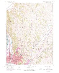
1956 Map of Council Bluffs North
USGS Topo · Published 1970About this map
Council Bluffs and the surrounding Loess Hills bluffs are captured during a period of significant urban expansion following the mid-century. While the core of the city is well-established around landmarks like Big Lake Park and St Francis Ch, purple-tinted photorevisions from 1969 show new residential growth pushing north and east toward Garner. The landscape is heavily defined by a dense concentration of neighborhood schools, including Roosevelt Sch, Harrison Sch, and Iowana Sch, reflecting the postwar population boom in Pottawattamie County.
Find a feature on this map
57 named features on this map. Tap any name to fly to it.
Don’t see what you’re looking for? This feature index may not catch every label — zoom into the map to look around manually.
Map Details
Editions of this 1956 Council Bluffs North Map
4 editions found
Other maps of this area

1893 · Omaha
USGS Topo · 1:62,500

1954 · Omaha
USGS Topo · 1:250,000

1956 · Underwood
USGS Topo · 1:24,000

1956 · Mineola
USGS Topo · 1:24,000

1956 · Council Bluffs North
USGS Topo · 1:24,000

1956 · Omaha North
USGS Topo · 1:24,000

1956 · Mc Clelland
USGS Topo · 1:24,000

1956 · Council Bluffs South
USGS Topo · 1:24,000

1956 · Omaha South
USGS Topo · 1:24,000

1957 · Omaha
USGS Topo · 1:250,000