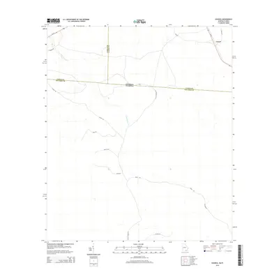
2014 Map of Council
USGS Topo · Published 2014About this map
Little Suwannee Cr meanders through this borderland where southern Georgia meets the Florida panhandle. The map centers on the rural settlement of Council, situated at the intersection of Ga-94 and Council Rd. This landscape is defined by its political boundaries, marking the convergence of Clinch, Echols, and Columbia counties. Transportation in this sparsely populated region relies on a network of named tracks such as Bushy Rd, Hound Rd, and Mule Lot Rd, which cut through the flat pine woods typical of the Suwannee River basin. The presence of Us-441 in the northwest corner provides the primary transit link through the area, while the interior remains a quiet expanse of drainages and local access roads like Little Suwannee Rd.
Find a feature on this map
22 named features on this map. Tap any name to fly to it.
Don’t see what you’re looking for? This feature index may not catch every label — zoom into the map to look around manually.
Map Details
Editions of this 2014 Council Map
This is the sole edition of this map. No revisions or reprints were ever made.
Other maps of this area

1954 · Valdosta
USGS Topo · 1:250,000

1955 · Council
USGS Topo · 1:24,000

1955 · Fargo SW
USGS Topo · 1:24,000

1956 · Sargent
USGS Topo · 1:24,000

1958 · Valdosta
USGS Topo · 1:250,000

1959 · Valdosta
USGS Topo · 1:250,000

1967 · Strange Island
USGS Topo · 1:24,000

1967 · Sargent
USGS Topo · 1:24,000

1967 · Fargo
USGS Topo · 1:24,000

1968 · Needmore
USGS Topo · 1:24,000