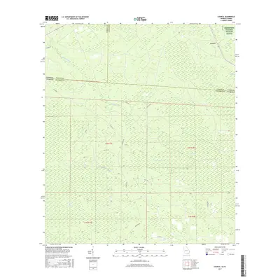
2017 Map of Council
USGS Topo · Published 2017About this map
Okefenokee National Wildlife Refuge anchors the northeast corner of this landscape, where the Georgia-Florida state line meets the junction of Echols, Clinch, and Columbia counties. The terrain is a complex network of wetlands and seasonal drainages, dominated by named features like White Arm Swamp, Pinhook Swamp, and Double Run Swamp. The small settlement of Council sits along the northern edge, connected to the surrounding timberlands and swamp margins by a grid of rural routes such as Council Rd and NE Benton Rd. The hydrology is defined by the winding course of Little Suwannee Creek and several isolated basins locally known as "bays," including Mett Bay and Sandlin Bay, illustrating the characteristic topography of the eastern Gulf Coastal Plain.
Find a feature on this map
35 named features on this map. Tap any name to fly to it.
Don’t see what you’re looking for? This feature index may not catch every label — zoom into the map to look around manually.
Map Details
Editions of this 2017 Council Map
This is the sole edition of this map. No revisions or reprints were ever made.
Other maps of this area

1954 · Valdosta
USGS Topo · 1:250,000

1955 · Council
USGS Topo · 1:24,000

1955 · Fargo SW
USGS Topo · 1:24,000

1956 · Sargent
USGS Topo · 1:24,000

1958 · Valdosta
USGS Topo · 1:250,000

1959 · Valdosta
USGS Topo · 1:250,000

1967 · Strange Island
USGS Topo · 1:24,000

1967 · Sargent
USGS Topo · 1:24,000

1967 · Fargo
USGS Topo · 1:24,000

1968 · Needmore
USGS Topo · 1:24,000