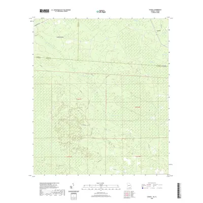
2020 Map of Council
USGS Topo · Published 2020About this map
Council stands at the northern edge of this landscape, situated near the boundary between Georgia and Florida. This 2020 survey reveals a remote lowland environment dominated by the intricate hydrology of the Okefenokee region. Extensive wetlands such as White Arm Swamp and Double Run Swamp characterize the terrain, while distinct depressions like Mett Bay, White Arm Bay, and Sandlin Bay dot the pine-forest grid. The area is defined by the winding course of Little Suwannee Creek, which traverses the central sections. Human activity is largely confined to a network of rural routes, including family-named roads like H Sirmans Ln and functional paths such as Mule Lot Rd and Pine Bark Rd. The map provides a clear record of the jurisdictional intersections between Echols County and Clinch County, Georgia, and their border with Columbia County, Florida.
Find a feature on this map
28 named features on this map. Tap any name to fly to it.
Don’t see what you’re looking for? This feature index may not catch every label — zoom into the map to look around manually.
Map Details
Editions of this 2020 Council Map
This is the sole edition of this map. No revisions or reprints were ever made.
Other maps of this area

1954 · Valdosta
USGS Topo · 1:250,000

1955 · Council
USGS Topo · 1:24,000

1955 · Fargo SW
USGS Topo · 1:24,000

1956 · Sargent
USGS Topo · 1:24,000

1958 · Valdosta
USGS Topo · 1:250,000

1959 · Valdosta
USGS Topo · 1:250,000

1967 · Strange Island
USGS Topo · 1:24,000

1967 · Sargent
USGS Topo · 1:24,000

1967 · Fargo
USGS Topo · 1:24,000

1968 · Needmore
USGS Topo · 1:24,000