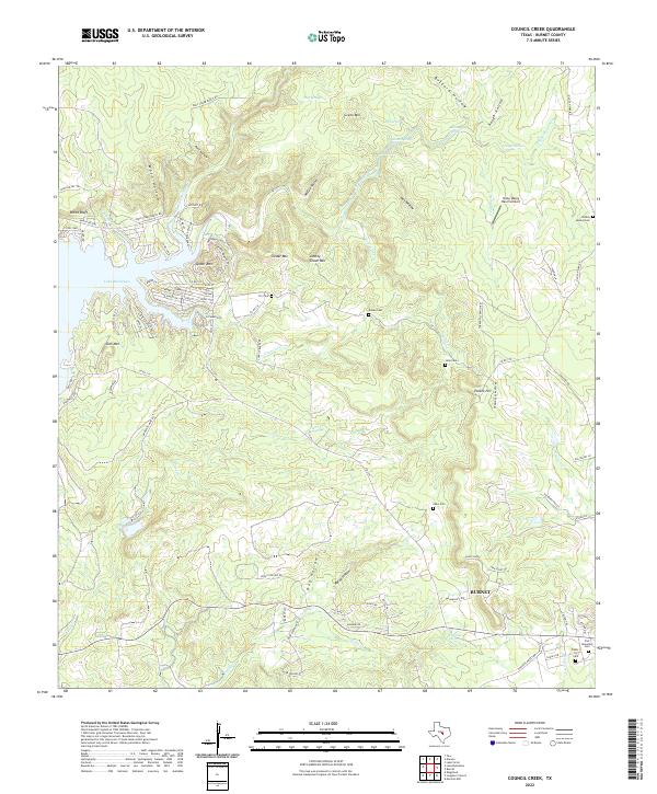
2022 Map of Council Creek
USGS Topo · Published 2022About this map
The eastern shores of Lake Buchanan and the rugged Hill Country terrain north of Burnet define this geographic study. The landscape is characterized by a series of prominent peaks and deep drainage basins, including Spider Mtn, Cedar Mtn, and Johhny Grave Mtn. These elevations are separated by numerous hollows such as Wolf Hollow and McCoy Hollow, which funnel water into the lake or south toward the city.
Find a feature on this map
98 named features on this map. Tap any name to fly to it.
Don’t see what you’re looking for? This feature index may not catch every label — zoom into the map to look around manually.
Map Details
Editions of this 2022 Council Creek Map
This is the sole edition of this map. No revisions or reprints were ever made.
Other maps of this area

1887 · Burnet
USGS Topo · 1:125,000

1893 · Burnet
USGS Topo · 1:125,000

1903 · Burnet
USGS Topo · 1:125,000

1909 · Burnet
USGS Topo · 1:125,000

1925 · Burnet 3-b
USGS Topo · 1:48,000
1925 · Burnet 2-c
USGS Topo · 1:48,000

1929 · Marble Falls
USGS Topo · 1:62,500

1932 · Tow
USGS Topo · 1:62,500

1932 · Marble Falls
USGS Topo · 1:62,500

1932 · Bertram
USGS Topo · 1:62,500