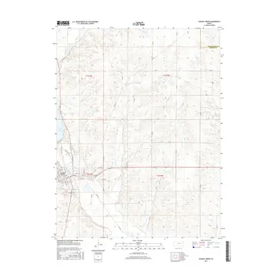
2015 Map of Council Grove
USGS Topo · Published 2015About this map
Council Grove serves as the focal point of this Kansas landscape, situated where the Neosho River and Elm Cr converge. The town's grid is well-defined by thoroughfares such as E Main St, N Mission St, and Market St, reflecting its historical importance as a river-centered trade hub. North of the settlement, the expansive waters of Council Grove Lake are fed by Munkers Creek, while the surrounding terrain is deeply incised by a network of drainage systems including Ritchey Cr, Big John Cr, and Little John Cr. This 2015 survey details the modern rural road network, with numbered routes like S 500 Rd and S 875 Rd crisscrossing the upland prairies of the t15s r8e and t16s r9e townships. The map captures the transition from the organized urban streets of the town site to the undulating creek valleys and ranch lands typical of the Flint Hills region.
Find a feature on this map
56 named features on this map. Tap any name to fly to it.
Don’t see what you’re looking for? This feature index may not catch every label — zoom into the map to look around manually.
Map Details
Editions of this 2015 Council Grove Map
This is the sole edition of this map. No revisions or reprints were ever made.
Other maps of this area

1885 · Eskridge
USGS Topo · 1:125,000

1889 · Parkerville
USGS Topo · 1:125,000

1889 · Eskridge
USGS Topo · 1:125,000

1894 · Eskridge
USGS Topo · 1:125,000

1894 · Parkerville
USGS Topo · 1:125,000

1955 · Hutchinson
USGS Topo · 1:250,000

1959 · Hutchinson
USGS Topo · 1:250,000

1971 · Alta Vista SE
USGS Topo · 1:24,000

1971 · Bushong
USGS Topo · 1:24,000

1971 · Alta Vista
USGS Topo · 1:24,000