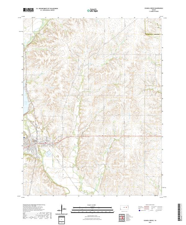
2022 Map of Council Grove
USGS Topo · Published 2022About this map
Council Grove serves as the focal point of this 2022 survey, situated along the banks of the Neosho River. As the seat of Morris County, the town's street grid is clearly defined, featuring the Morris County Courthouse and a network of local thoroughfares like W Main St and N Mission St. The geography is shaped by the transition from the upland prairies to the river valley, with the massive Council Grove Lake dominating the western edge of the area. Numerous waterways, including Big John Cr, Munkers Creek, and Ritchey Cr, carve through the surrounding townships, indicating a landscape heavily influenced by both natural drainage and modern water management. The intersection of Old Hwy 56 and Old Hwy 4 reflects the enduring importance of these transportation corridors in east-central Kansas.
Find a feature on this map
59 named features on this map. Tap any name to fly to it.
Don’t see what you’re looking for? This feature index may not catch every label — zoom into the map to look around manually.
Map Details
Editions of this 2022 Council Grove Map
This is the sole edition of this map. No revisions or reprints were ever made.
Other maps of this area

1885 · Eskridge
USGS Topo · 1:125,000

1889 · Parkerville
USGS Topo · 1:125,000

1889 · Eskridge
USGS Topo · 1:125,000

1894 · Eskridge
USGS Topo · 1:125,000

1894 · Parkerville
USGS Topo · 1:125,000

1955 · Hutchinson
USGS Topo · 1:250,000

1959 · Hutchinson
USGS Topo · 1:250,000

1971 · Alta Vista SE
USGS Topo · 1:24,000

1971 · Bushong
USGS Topo · 1:24,000

1971 · Alta Vista
USGS Topo · 1:24,000