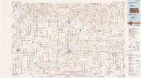
1985 Map of Council Grove
USGS Topo · Published 1990About this map
Council Grove Lake dominates the central landscape of this 1980s survey, marking a significant water management feature on the Neosho River system. The map captures the agricultural heart of the Flint Hills region during a period of established rural settlement, showing the transition from the Smoky Hill River in the northwest to the complex drainage basins of Kahola Creek and Duck Creek in the south.
Find a feature on this map
74 named features on this map. Tap any name to fly to it.
Don’t see what you’re looking for? This feature index may not catch every label — zoom into the map to look around manually.
Map Details
Editions of this 1985 Council Grove Map
2 editions found
Other maps of this area

1885 · Eskridge
USGS Topo · 1:125,000

1885 · Burlington
USGS Topo · 1:125,000

1886 · Junction City
USGS Topo · 1:125,000

1888 · Emporia
USGS Topo · 1:125,000

1889 · Burlingame
USGS Topo · 1:125,000

1889 · Newton
USGS Topo · 1:125,000

1889 · Wamego
USGS Topo · 1:125,000

1889 · Junction City
USGS Topo · 1:125,000

1889 · Abilene
USGS Topo · 1:125,000

1889 · Parkerville
USGS Topo · 1:125,000