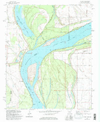
1981 Map of Council
USGS Topo · Published 1997About this map
The Mississippi River dominates this landscape, defining the fluid border between Arkansas and Mississippi as it creates complex landforms like Peters Island and Rabbit Island. The importance of river transportation is evident through numerous historic points such as Lady Lee-Campbell Landing, Ashley Point Landing, and Commerce Landing. Along the western bank, the St Francis Levee provides a massive engineered barrier, shielding low-lying areas and the settlement of Peters from the river's seasonal shifts. Local community life is anchored by landmarks like the Peters Ch Cem and rural congregations at Happy Ch and Hopewell Ch. The presence of oxbows like Midway Lake and Old River Lake illustrates the river's historical path, while the Commerce Revetment shows the ongoing efforts to stabilize these vital banks in the late twentieth century.
Find a feature on this map
39 named features on this map. Tap any name to fly to it.
Don’t see what you’re looking for? This feature index may not catch every label — zoom into the map to look around manually.
Map Details
Editions of this 1981 Council Map
Other maps of this area

1908 · Hollywood
USGS Topo · 1:24,000

1913 · Hollywood
USGS Topo · 1:31,680

1931 · Horseshoe Lake
USGS Topo · 1:62,500

1939 · Clayton
USGS Topo · 1:62,500

1939 · Horseshoe Lake
USGS Topo · 1:62,500

1939 · Park Place
USGS Topo · 1:62,500

1939 · Latour
USGS Topo · 1:62,500

1948 · Helena
USGS Topo · 1:250,000

1950 · Helena
USGS Topo · 1:250,000

1954 · Horseshoe Lake
USGS Topo · 1:62,500