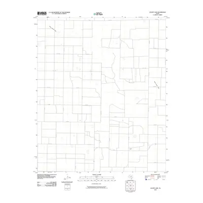
2010 Map of County Line
USGS Topo · Published 2010About this map
County Line occupies a landscape defined by the expansive agricultural grid of the Texas South Plains. The settlement is situated at a critical junction of rural transit, where FM 597 and several county roads meet. The terrain is remarkably level, punctuated only by the subtle depression of Yellow House Draw, which meanders across the northern portion of the quadrangle. This intermittent drainage feature is a significant natural landmark in an otherwise engineered environment of section lines and farm-to-market roads. The map illustrates a high degree of rural connectivity through an extensive network of local routes, including FM 3305 and FM 54, serving the dispersed farmsteads and agricultural operations characteristic of Bailey County.
Find a feature on this map
27 named features on this map. Tap any name to fly to it.
Don’t see what you’re looking for? This feature index may not catch every label — zoom into the map to look around manually.
Map Details
Editions of this 2010 County Line Map
This is the sole edition of this map. No revisions or reprints were ever made.
Other maps of this area

1954 · Brownfield
USGS Topo · 1:250,000

1958 · Brownfield
USGS Topo · 1:250,000

1962 · Brownfield
USGS Topo · 1:250,000

1964 · Pep
USGS Topo · 1:24,000
1964 · Beck
USGS Topo · 1:24,000

1965 · Pettit
USGS Topo · 1:24,000
1968 · Bula
USGS Topo · 1:24,000
1968 · Upper White Lake
USGS Topo · 1:24,000

1969 · Enochs
USGS Topo · 1:24,000

1971 · Whiteface NW
USGS Topo · 1:24,000