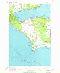
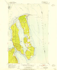
1953 Map of Coupeville
USGS Topo · Published 1973About this map
Penn Cove cuts deep into the heart of Whidbey Island, shaping the character of Coupeville and its surrounding agricultural prairies during the early 1950s. The landscape is a mix of maritime utility and established military presence, with the Fort Casey Military Reservation guarding the strategic waters of Admiralty Inlet and Puget Sound. Inland, the expansive Ebeys Prairie and Smith Prairie show a pattern of rural settlement, supported by local institutions like the Coupeville School and punctuated by a traditional Windmill. Along the southern coast, the Keystone Ferry Landing and Keystone Harbor serve as vital transit points near the marshes of Crockett Lake. This period also reflects the expanding footprint of the Whidbey Island Naval Air Station to the east, while smaller communities like San De Fuca and Prairie Center maintain their local identities amidst the island's coastal bluffs and lagoons.
Find a feature on this map
42 named features on this map. Tap any name to fly to it.
Don’t see what you’re looking for? This feature index may not catch every label — zoom into the map to look around manually.
Map Details
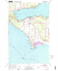
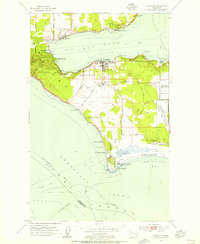
Editions of this 1953 Coupeville Map
3 editions found
Other maps of this area

1939 · Port Townsend
USGS Topo · 1:62,500

1939 · Coupeville
USGS Topo · 1:62,500

1943 · Richardson
USGS Topo · 1:62,500

1943 · Deception Pass
USGS Topo · 1:62,500

1951 · Deception Pass
USGS Topo · 1:62,500
1953 · Coupeville
USGS Topo · 1:24,000
1953 · Freeland
USGS Topo · 1:24,000
1953 · Nordland
USGS Topo · 1:24,000
1953 · Camano
USGS Topo · 1:24,000
1953 · Port Townsend North
USGS Topo · 1:24,000