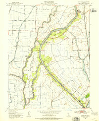
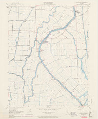
1952 Map of Courtland
USGS Topo · Published 1953About this map
Sacramento River meanders through this agricultural heartland, defining the intricate network of levees and sloughs that shaped the development of the Delta. In the early 1950s, the landscape was a patchwork of massive river-islands including Grand Island, Sutter Island, and Randall Island, where complex water management is evident through numerous Pump Houses and drainage canals. The maps shows the close relationship between the water and the rail, with the Southern Pacific line running north-south through Hood while riverfront settlements like Courtland and the distinctive community of Locke serve as historic hubs for the region's shipping and transit. The density of named sloughs, such as Snodgrass Slough and Steamboat Slough, reveals a world where the waterways were the primary arteries of commerce and communication before the modernization of the valley's road network.
Find a feature on this map
38 named features on this map. Tap any name to fly to it.
Don’t see what you’re looking for? This feature index may not catch every label — zoom into the map to look around manually.
Map Details
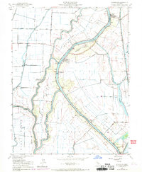
Editions of this 1952 Courtland Map
6 editions found
Other maps of this area

1894 · Lodi
USGS Topo · 1:125,000

1908 · Courtland
USGS Topo · 1:62,500

1909 · Florin
USGS Topo · 1:31,680

1910 · New Hope
USGS Topo · 1:31,680

1910 · Rio Vista
USGS Topo · 1:31,680

1910 · Bruceville
USGS Topo · 1:31,680

1910 · Isleton
USGS Topo · 1:31,680

1916 · Cache Slough
USGS Topo · 1:31,680

1916 · Vorden
USGS Topo · 1:31,680
1916 · Babel Slough
USGS Topo · 1:31,680