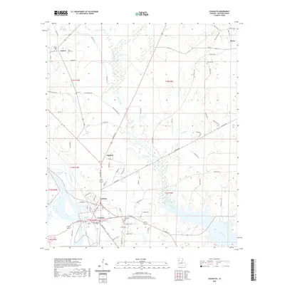
2020 Map of Coushatta
USGS Topo · Published 2020About this map
Coushatta serves as the focal point of this Red River Parish landscape, anchored by the Red River Parish Courthouse and the meandering course of the Red River. The settlement pattern follows a mix of riverine geography and a well-defined road network, including Ashland Rd and Shreveport Rd. To the north and east, smaller communities like Edgefield, Halfway, and Martin are interspersed among a complex system of waterways such as Coney Bayou, Grand Bayou, and Bayou Nicholas. Local genealogy is well-supported by numerous burial sites, including Springville Cem, New Star Cem, and Hand Cem, which are scattered throughout the surrounding countryside. The map illustrates a balance between the developed town center and the surrounding wetlands and bayous that define this portion of North Louisiana.
Find a feature on this map
90 named features on this map. Tap any name to fly to it.
Don’t see what you’re looking for? This feature index may not catch every label — zoom into the map to look around manually.
Map Details
Editions of this 2020 Coushatta Map
This is the sole edition of this map. No revisions or reprints were ever made.
Other maps of this area

1937 · Campti NW
USGS Topo · 1:31,680

1938 · Chemard Lake
USGS Topo · 1:31,680

1938 · Lake End
USGS Topo · 1:31,680

1941 · East Point
USGS Topo · 1:31,680

1944 · Campti
USGS Topo · 1:62,500

1947 · Ashland
USGS Topo · 1:62,500

1947 · Hanna
USGS Topo · 1:62,500

1948 · Coushatta
USGS Topo · 1:62,500

1948 · Campti
USGS Topo · 1:62,500

1953 · Alexandria
USGS Topo · 1:250,000