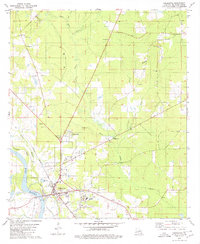
1979 Map of Coushatta
USGS Topo · Published 1980About this map
The Red River corridor defines this part of Red River Parish, where the town of Coushatta serves as a central hub for transportation and commerce. In the late 1970s, the area's economy is clearly anchored by the Kansas City Southern railroad and the Coushatta Field petroleum operations, indicated by several Gas Wells and Drill Holes scattered across the landscape. The settlement pattern is largely rural and ecclesiastical, with a high density of country churches such as St Pauls Ch, New Star Ch, and Liberty Hill Ch serving local families and providing key genealogical markers.
Find a feature on this map
33 named features on this map. Tap any name to fly to it.
Don’t see what you’re looking for? This feature index may not catch every label — zoom into the map to look around manually.
Map Details
Editions of this 1979 Coushatta Map
This is the sole edition of this map. No revisions or reprints were ever made.
Other maps of this area

1937 · Campti NW
USGS Topo · 1:31,680

1938 · Chemard Lake
USGS Topo · 1:31,680

1938 · Lake End
USGS Topo · 1:31,680

1941 · East Point
USGS Topo · 1:31,680

1944 · Campti
USGS Topo · 1:62,500

1947 · Ashland
USGS Topo · 1:62,500

1947 · Hanna
USGS Topo · 1:62,500

1948 · Coushatta
USGS Topo · 1:62,500

1948 · Campti
USGS Topo · 1:62,500

1953 · Alexandria
USGS Topo · 1:250,000