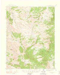
1948 Map of Cover Mtn.
USGS Topo · Published 1948About this map
Isolated homesteads and rugged mountain terrain define this 1948 survey of the borderlands between Fremont Co and Park County. The landscape is marked by a network of established family operations like Stahl Ranch, Nash Ranch, and F L Rowe Ranch, reflecting the area's mid-century ranching economy. Industrial activity is centered at the Colorado Feldspar Company Mine in the northern reaches, while the presence of the Wilson Creek Sch and Twelvemile Sch indicates small, localized communities scattered through the valleys of Currant Creek and its many gulches. The terrain is dominated by prominent summits such as Cover Mtn, Thompson Mtn, and Gribble Mountain, with open ranching lands found at Eightmile Park and Shaws Park. This map provides a detailed look at the rural infrastructure of the Colorado high country before significant modern development, capturing the original road networks and property boundaries of the era.
Find a feature on this map
69 named features on this map. Tap any name to fly to it.
Don’t see what you’re looking for? This feature index may not catch every label — zoom into the map to look around manually.
Map Details
Editions of this 1948 Cover Mtn. Map
3 editions found
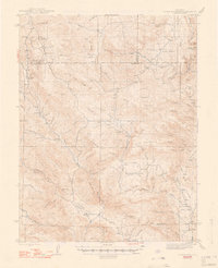
Other maps of this area

1889 · Canon City
USGS Topo · 1:125,000

1892 · Canon City
USGS Topo · 1:125,000

1894 · Pikes Peak
USGS Topo · 1:125,000

1901 · Pikes Peak
USGS Topo · 1:125,000

1901 · Pikes Peak
USGS Topo · 1:62,500

1942 · Cover Mtn.
USGS Topo · 1:62,500

1948 · Cover Mtn.
USGS Topo · 1:62,500

1951 · Cripple Creek South
USGS Topo · 1:24,000

1951 · Cripple Creek North
USGS Topo · 1:24,000

1954 · Cooper Mountain
USGS Topo · 1:24,000