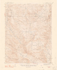
1948 Map of Cover Mtn.
USGS Topo · Published 1948About this map
Colorado Feldspar Company Mine and a network of family-held cattle ranches characterize this high-country landscape during the 1940s. The survey captures the rural infrastructure of central Colorado, where life centered around landmarks like Stahl Ranch, Nash Ranch, and F L Rowe Ranch. Local education is anchored at Wilson Creek Sch and Twelvemile Sch, serving the scattered homesteads across the drainage basins of Fourmile Creek and Currant Creek.
Find a feature on this map
63 named features on this map. Tap any name to fly to it.
Don’t see what you’re looking for? This feature index may not catch every label — zoom into the map to look around manually.
Map Details
Editions of this 1948 Cover Mtn. Map
3 editions found
Other maps of this area

1889 · Canon City
USGS Topo · 1:125,000

1892 · Canon City
USGS Topo · 1:125,000

1894 · Pikes Peak
USGS Topo · 1:125,000

1901 · Pikes Peak
USGS Topo · 1:125,000

1901 · Pikes Peak
USGS Topo · 1:62,500

1942 · Cover Mtn.
USGS Topo · 1:62,500

1948 · Cover Mtn.
USGS Topo · 1:62,500

1951 · Cripple Creek South
USGS Topo · 1:24,000

1951 · Cripple Creek North
USGS Topo · 1:24,000

1954 · Cooper Mountain
USGS Topo · 1:24,000