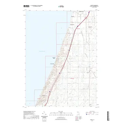
2019 Map of Covert
USGS Topo · Published 2019About this map
Lake Michigan dominates the western edge of this coastal landscape, where the shifting sands meet the developed shoreline of Van Buren County. The terrain transitions from the dunes at Thunder Mtn and the marshes of Dyckman Swamp to the organized agricultural and residential grids further inland. Coastal communities like Palisades Park, Crystal Beach, and Linden Hills highlight the area's long-standing appeal for seasonal and permanent residency along the lake.
Find a feature on this map
49 named features on this map. Tap any name to fly to it.
Don’t see what you’re looking for? This feature index may not catch every label — zoom into the map to look around manually.
Map Details
Editions of this 2019 Covert Map
This is the sole edition of this map. No revisions or reprints were ever made.
Other maps of this area

1927 · Hartford
USGS Topo · 1:62,500

1927 · Bangor
USGS Topo · 1:62,500

1927 · Benton Harbor
USGS Topo · 1:62,500

1927 · South Haven
USGS Topo · 1:62,500

1930 · South Haven
USGS Topo · 1:62,500

1930 · Benton Harbor
USGS Topo · 1:62,500

1931 · Bangor
USGS Topo · 1:62,500

1931 · Hartford
USGS Topo · 1:62,500

1943 · South Haven
USGS Topo · 1:62,500

1943 · Bangor
USGS Topo · 1:62,500