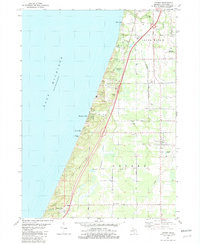
1981 Map of Covert
USGS Topo · Published 1982About this map
Lake Michigan dominates the western edge of this coastal survey, where the shoreline is defined by the dunes of Van Buren State Park and the elevated vantage of Thunder Mtn. Inland, the landscape of Van Buren Co. transitions from the marshy grounds of Dyckman Swamp and Brandywine Creek to an organized grid of fruit-growing and transport infrastructure. The Chesapeake and Ohio railroad corridor runs parallel to the Blue Star Memorial Highway, anchoring the community of Covert and the smaller cluster at Fish Corners. Local history and genealogy interests are well-represented by the presence of Fish Cem and landmarks like Trinity Ch. The map also details the early 1980s expansion of lakeside living in Palisades Park and Linden Hills, alongside industrial markers like the Powerplant and various sandpits.
Find a feature on this map
46 named features on this map. Tap any name to fly to it.
Don’t see what you’re looking for? This feature index may not catch every label — zoom into the map to look around manually.
Map Details
Editions of this 1981 Covert Map
This is the sole edition of this map. No revisions or reprints were ever made.
Other maps of this area

1927 · Hartford
USGS Topo · 1:62,500

1927 · Bangor
USGS Topo · 1:62,500

1927 · Benton Harbor
USGS Topo · 1:62,500

1927 · South Haven
USGS Topo · 1:62,500

1930 · South Haven
USGS Topo · 1:62,500

1930 · Benton Harbor
USGS Topo · 1:62,500

1931 · Bangor
USGS Topo · 1:62,500

1931 · Hartford
USGS Topo · 1:62,500

1943 · South Haven
USGS Topo · 1:62,500

1943 · Bangor
USGS Topo · 1:62,500