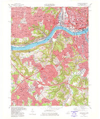
1981 Map of Covington
USGS Topo · Published 1981About this map
The Ohio River forms the central artery of this 1981 survey, separating the urban cores of Cincinnati and Covington. While the northern bank is dominated by the dense grid of downtown Cincinnati and neighborhoods like Price Hill and Delhi Hills, the Kentucky side reveals a landscape of rapidly expanding suburban communities including Villa Hills, Fort Wright, and Lakeside Park. The transportation network is a complex layering of era-defining infrastructure, from the historic Anderson Ferry to the massive interchanges of Dixie Hwy and the extensive rail corridors of the L & N RR and Conrail. Significant institutional landmarks are scattered throughout the hills, including Thomas More College, Villa Madonna Academy, and several major burial grounds like Highland Cemetery and St Josephs Cemetery, which provide stable reference points for genealogists tracing family roots in Kenton and Hamilton counties.
Find a feature on this map
138 named features on this map. Tap any name to fly to it.
Don’t see what you’re looking for? This feature index may not catch every label — zoom into the map to look around manually.
Map Details
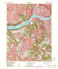
Editions of this 1981 Covington Map
2 editions found
Other maps of this area

1898 · East Cincinnati
USGS Topo · 1:62,500

1914 · East Cincinnati
USGS Topo · 1:62,500

1914 · West Cincinnati
USGS Topo · 1:62,500

1929 · Alexandria
USGS Topo · 1:48,000

1936 · Alexandria
USGS Topo · 1:62,500

1950 · Union
USGS Topo · 1:24,000

1950 · Independence
USGS Topo · 1:24,000

1950 · Covington
USGS Topo · 1:24,000

1951 · Burlington
USGS Topo · 1:24,000

1952 · Newport
USGS Topo · 1:24,000