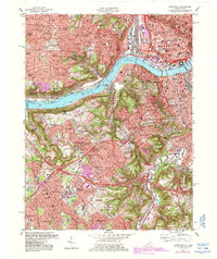
1981 Map of Covington
USGS Topo · Published 1987About this map
The Ohio River acts as the central artery for this urban corridor, dividing the industrial and residential reaches of Cincinnati from the riverfront cities of Covington, Ludlow, and Bromley. The map details a landscape of heavy infrastructure, from the Riverfront Stadium and a dense network of downtown Cincinnati streets to the massive rail yards and interchanges serving the Sou, Conrail, and CSX lines. South of the river, the terrain climbs into the hills of Park Hills and Fort Mitchell, where post-war suburban growth is evidenced by numerous schools like St Agnes Sch and institutions such as Thomas More College.
Find a feature on this map
141 named features on this map. Tap any name to fly to it.
Don’t see what you’re looking for? This feature index may not catch every label — zoom into the map to look around manually.
Map Details
Editions of this 1981 Covington Map
2 editions found
Other maps of this area

1898 · East Cincinnati
USGS Topo · 1:62,500

1914 · East Cincinnati
USGS Topo · 1:62,500

1914 · West Cincinnati
USGS Topo · 1:62,500

1929 · Alexandria
USGS Topo · 1:48,000

1936 · Alexandria
USGS Topo · 1:62,500

1950 · Union
USGS Topo · 1:24,000

1950 · Independence
USGS Topo · 1:24,000

1950 · Covington
USGS Topo · 1:24,000

1951 · Burlington
USGS Topo · 1:24,000

1952 · Newport
USGS Topo · 1:24,000