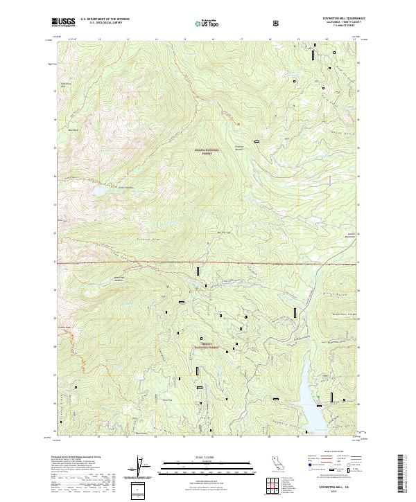
2021 Map of Covington Mill
USGS Topo · Published 2021About this map
Trinity Lake and the high mountain drainages of the Shasta National Forest dominate this landscape within the Trinity Alps. The map illustrates a complex network of canyons and gulches, including the distinct Billys Gulch and Bowerman Gulch, which feed into the primary water systems. Evidence of early hydraulic or agricultural history is present through the marking of Diener Ditch, while the peaks of Gibson Peak and Granite Peak define the topographical limits. Small mountain flats and clearings like Elderberry Duff and Echo Flat suggest seasonal use or small-scale settlements in an area otherwise characterized by ridges such as Stoney Ridge and Buck Ridge. The presence of numerous trails, including the Swift Creek Trl and Granite Lake Trl, highlights the long-standing importance of backcountry access to high-altitude water bodies like Seven Up Lake and Lake Eleanor.
Find a feature on this map
76 named features on this map. Tap any name to fly to it.
Don’t see what you’re looking for? This feature index may not catch every label — zoom into the map to look around manually.
Map Details
Editions of this 2021 Covington Mill Map
This is the sole edition of this map. No revisions or reprints were ever made.
Other maps of this area

1886 · Shasta
USGS Topo · 1:250,000

1890 · Red Bluff
USGS Topo · 1:250,000

1894 · Red Bluff
USGS Topo · 1:250,000

1894 · Shasta
USGS Topo · 1:250,000

1913 · Weaverville
USGS Topo · 1:125,000

1923 · Sawyers Bar
USGS Topo · 1:125,000

1931 · Etna
USGS Topo · 1:96,000

1934 · Etna
USGS Topo · 1:125,000

1948 · Weed
USGS Topo · 1:250,000

1950 · Weed
USGS Topo · 1:250,000