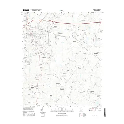
2014 Map of Covington
USGS Topo · Published 2014About this map
Covington serves as the focal point of this 2014 survey, where the urban street grid meets the winding course of the Alcovy River. The landscape is a complex mix of established city neighborhoods and a dense network of residential developments such as Settlers Grove, Newton Ridge, and Meadowood Subdivision. Significant for local historians and genealogists, the map identifies numerous small burial grounds including the Confederate Soldiers Cem and the Rakestraw Cem, alongside outlying rural points like Starrsville and Hayston. Small airfields such as Windy Hill Airport and Neely Farms Airport punctuate the terrain, reflecting the modern utility of the land between the watercourses of Dried Indian Cr and Wrights Cr. This document provides a clear look at how the infrastructure of Newton County has expanded around its historical core while maintaining its character through preserved family and community landmarks.
Find a feature on this map
198 named features on this map. Tap any name to fly to it.
Don’t see what you’re looking for? This feature index may not catch every label — zoom into the map to look around manually.
Map Details
Editions of this 2014 Covington Map
This is the sole edition of this map. No revisions or reprints were ever made.
Other maps of this area

1896 · Monroe
USGS Topo · 1:125,000

1953 · Athens
USGS Topo · 1:250,000

1958 · Athens
USGS Topo · 1:250,000

1959 · Athens
USGS Topo · 1:250,000

1963 · Athens
USGS Topo · 1:250,000

1964 · Stewart
USGS Topo · 1:24,000

1964 · Worthville
USGS Topo · 1:24,000

1964 · Porterdale
USGS Topo · 1:24,000

1964 · Covington
USGS Topo · 1:24,000
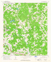
1964 · Milstead
USGS Topo · 1:24,000