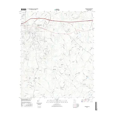
2017 Map of Covington
USGS Topo · Published 2017About this map
The city of Covington serves as the focal point of this Newton County landscape, where urban street grids transition into a rural network of ridges and river valleys. The Alcovy River and its numerous tributaries, including Hurricane Cr and Wrights Cr, carve through the terrain, flanked by notable elevations like Alcovy Ridge and River Cove Ridge. This geography historically dictated the placement of outlying settlements such as Starrsville and Hayston, which remain connected by a web of traditional county roads.
Find a feature on this map
212 named features on this map. Tap any name to fly to it.
Don’t see what you’re looking for? This feature index may not catch every label — zoom into the map to look around manually.
Map Details
Editions of this 2017 Covington Map
This is the sole edition of this map. No revisions or reprints were ever made.
Other maps of this area

1896 · Monroe
USGS Topo · 1:125,000

1953 · Athens
USGS Topo · 1:250,000

1958 · Athens
USGS Topo · 1:250,000

1959 · Athens
USGS Topo · 1:250,000

1963 · Athens
USGS Topo · 1:250,000

1964 · Stewart
USGS Topo · 1:24,000

1964 · Worthville
USGS Topo · 1:24,000

1964 · Porterdale
USGS Topo · 1:24,000

1964 · Covington
USGS Topo · 1:24,000
1964 · Milstead
USGS Topo · 1:24,000