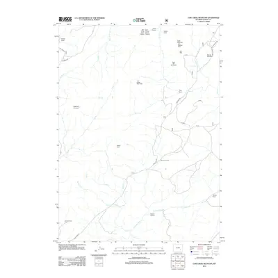
2012 Map of Cow Creek Mountain
USGS Topo · Published 2012About this map
Burnett Cow Camp and Bob Garett Cow Camp anchor the ranching landscape of northern Albany County in this high-plains survey. The terrain is defined by a series of prominent peaks and drainage systems, most notably Cow Creek Mountain and Indian Peak. To the south, the N Laramie River winds through the territory, joined by tributaries like Potato Creek and Tweety Creek.
Find a feature on this map
40 named features on this map. Tap any name to fly to it.
Don’t see what you’re looking for? This feature index may not catch every label — zoom into the map to look around manually.
Map Details
Editions of this 2012 Cow Creek Mountain Map
This is the sole edition of this map. No revisions or reprints were ever made.
Other maps of this area

1943 · Esterbrook
USGS Topo · 1:62,500

1945 · Esterbrook
USGS Topo · 1:62,500

1954 · Torrington
USGS Topo · 1:250,000

1958 · Torrington
USGS Topo · 1:250,000

1964 · Toltec
USGS Topo · 1:24,000

1964 · Windy Peak
USGS Topo · 1:24,000

1968 · Cow Creek Mountain
USGS Topo · 1:24,000

1968 · Davidson Flats
USGS Topo · 1:24,000

1968 · Cottonwood Creek
USGS Topo · 1:24,000
1968 · South Mountain
USGS Topo · 1:24,000