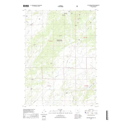
2017 Map of Cow Creek Mountain
USGS Topo · Published 2017About this map
Medicine Bow National Forest dominates this section of the Laramie Mountains, where high peaks and deep drainages define the high-country landscape. Rising above the terrain are prominent summits including Cow Creek Mtn, Jack Squirrel Peak, and Eagle Mtn. The hydrological network is led by the N Laramie River and its varied tributaries like Muddy Ford Cr, Potato Creek, and Owl Cr. The presence of Bay Homestead Rd and Parker Homestead Rd reflects the long-standing ranching and settlement history of Albany County. While the terrain is characterized by steep features such as East Prong Green Canyon and Wildcat Gulch, the map also documents the accessibility of these peaks via the Pole Draw Rd and Bear Creek Rd networks.
Find a feature on this map
45 named features on this map. Tap any name to fly to it.
Don’t see what you’re looking for? This feature index may not catch every label — zoom into the map to look around manually.
Map Details
Editions of this 2017 Cow Creek Mountain Map
This is the sole edition of this map. No revisions or reprints were ever made.
Other maps of this area

1943 · Esterbrook
USGS Topo · 1:62,500

1945 · Esterbrook
USGS Topo · 1:62,500

1954 · Torrington
USGS Topo · 1:250,000

1958 · Torrington
USGS Topo · 1:250,000

1964 · Toltec
USGS Topo · 1:24,000

1964 · Windy Peak
USGS Topo · 1:24,000

1968 · Cow Creek Mountain
USGS Topo · 1:24,000

1968 · Davidson Flats
USGS Topo · 1:24,000

1968 · Cottonwood Creek
USGS Topo · 1:24,000
1968 · South Mountain
USGS Topo · 1:24,000