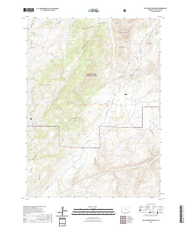
2021 Map of Cow Creek Mountain
USGS Topo · Published 2021About this map
Medicine Bow National Forest dominates this section of Albany County, where the Laramie Range rises into prominent summits like Cow Creek Mtn and Eagle Mtn. The landscape is a complex network of high-country drainages, including Cow Cr, Bear Cr, and Willow Cr, all contributing to the N Laramie River which cuts through the southern portion of the quadrangle. The map reveals the access routes used by generations of ranchers and forestry workers, from the winding Esterbrook Rd to the more primitive Cow Creek Mountain Trl. Named points like Jack Squirrel Peak and Indian Peak provide clear orientation in this high-elevation terrain, while family-linked identifiers like Parker Homestead Rd and Buckland Draw hint at the area's agricultural and homesteading legacy in the Wyoming interior.
Find a feature on this map
46 named features on this map. Tap any name to fly to it.
Don’t see what you’re looking for? This feature index may not catch every label — zoom into the map to look around manually.
Map Details
Editions of this 2021 Cow Creek Mountain Map
This is the sole edition of this map. No revisions or reprints were ever made.
Other maps of this area

1943 · Esterbrook
USGS Topo · 1:62,500

1945 · Esterbrook
USGS Topo · 1:62,500

1954 · Torrington
USGS Topo · 1:250,000

1958 · Torrington
USGS Topo · 1:250,000

1964 · Toltec
USGS Topo · 1:24,000

1964 · Windy Peak
USGS Topo · 1:24,000

1968 · Cow Creek Mountain
USGS Topo · 1:24,000

1968 · Davidson Flats
USGS Topo · 1:24,000

1968 · Cottonwood Creek
USGS Topo · 1:24,000
1968 · South Mountain
USGS Topo · 1:24,000