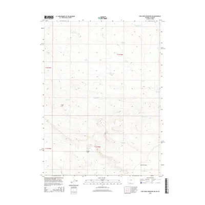
2015 Map of Cow Creek Reservoir SW
USGS Topo · Published 2015About this map
Kinney Rim dominates the western edge of this Sweetwater County landscape, where an intricate network of livestock water management defines the high desert terrain. The area is marked by numerous small impoundments and catchments, including the W Cow Cr Ranch Reservoir and Humbolt Reservoir, supporting ranching operations in a region of significant elevation change. This 2015 survey reveals the topographical complexity of the high plains, where drainage features like Crooked Wash and Eagle Rock Draw channel seasonal runoff through the sagebrush-covered hills. The distribution of features like Espitallier Spring and the High Center Reservoir illustrates the persistent reliance on scattered water sources across the Great Divide Basin's rugged southwestern reaches.
Find a feature on this map
21 named features on this map. Tap any name to fly to it.
Don’t see what you’re looking for? This feature index may not catch every label — zoom into the map to look around manually.
Map Details
Editions of this 2015 Cow Creek Reservoir SW Map
This is the sole edition of this map. No revisions or reprints were ever made.
Other maps of this area

1954 · Vernal
USGS Topo · 1:250,000

1954 · Rock Springs
USGS Topo · 1:250,000

1958 · Vernal
USGS Topo · 1:250,000

1958 · Rock Springs
USGS Topo · 1:250,000

1960 · Vernal
USGS Topo · 1:250,000

1962 · Rock Springs
USGS Topo · 1:250,000

1966 · Hiawatha
USGS Topo · 1:24,000

1968 · Chicken Creek East
USGS Topo · 1:24,000
1968 · Chicken Creek SE
USGS Topo · 1:24,000

1969 · Coffeepot Spring
USGS Topo · 1:24,000