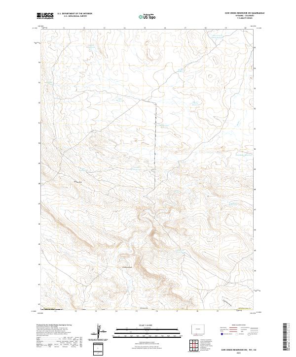
2021 Map of Cow Creek Reservoir SW
USGS Topo · Published 2021About this map
Kinney Rim defines the high-altitude topography of this corner of Sweetwater County during the early 21st century. The arid landscape is marked by a complex network of man-made water catchments, reflecting the region's reliance on managed water resources for livestock or local management. Named features like Rocky Reservoir, Humbolt Reservoir, and Muir Reservoir appear alongside more descriptively titled spots such as Forsaken Reservoir and Dead End Reservoir. Seasonal drainage patterns are traced by the winding Shell Cr and Crooked Wash, while Espitallier Spring indicates a rare natural water source in an otherwise dry terrain. This 2021 update by the U.S. Geological Survey preserves the specific nomenclature of these reservoirs and the varied landforms of the high Wyoming plains.
Find a feature on this map
23 named features on this map. Tap any name to fly to it.
Don’t see what you’re looking for? This feature index may not catch every label — zoom into the map to look around manually.
Map Details
Editions of this 2021 Cow Creek Reservoir SW Map
This is the sole edition of this map. No revisions or reprints were ever made.
Other maps of this area

1954 · Vernal
USGS Topo · 1:250,000

1954 · Rock Springs
USGS Topo · 1:250,000

1958 · Vernal
USGS Topo · 1:250,000

1958 · Rock Springs
USGS Topo · 1:250,000

1960 · Vernal
USGS Topo · 1:250,000

1962 · Rock Springs
USGS Topo · 1:250,000

1966 · Hiawatha
USGS Topo · 1:24,000

1968 · Chicken Creek East
USGS Topo · 1:24,000
1968 · Chicken Creek SE
USGS Topo · 1:24,000

1969 · Coffeepot Spring
USGS Topo · 1:24,000