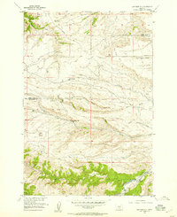
1955 Map of Cow Face Hill
USGS Topo · Published 1957About this map
The Stone Breastwork (Indian Battlesite) stands as a silent sentinel on the high ground overlooking Badger Creek, marking a location of significant historical conflict in the Montana frontier. Published in 1957, this survey documents the rural character of the border between Sweet Grass and Stillwater counties. Education in these sprawling ranchlands was anchored by local institutions like Stockade Sch and Upper Spring Creek Sch, positioned near the drainages that dictated settlement patterns. The southern portion of the map is dominated by the Stillwater River corridor, where Bluebell Lake and the confluence of Trout Creek provide a stark contrast to the drier uplands of Cow Face Hill. Complex drainages including Elliot Draw, Clark Draw, and Dry Gulch underscore the difficult terrain of the region during the mid-twentieth century.
Find a feature on this map
18 named features on this map. Tap any name to fly to it.
Don’t see what you’re looking for? This feature index may not catch every label — zoom into the map to look around manually.
Map Details
Editions of this 1955 Cow Face Hill Map
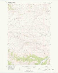
2 editions found
Other maps of this area

1891 · Big Timber
USGS Topo · 1:125,000

1893 · Big Timber
USGS Topo · 1:125,000

1898 · Granite Mountain District
USGS Topo · 1:125,000

1932 · Nye No 1
USGS Topo · 1:48,000

1932 · Nye No 2
USGS Topo · 1:48,000

1939 · Mt Wood
USGS Topo · 1:62,500

1941 · Mt. Wood
USGS Topo · 1:62,500

1954 · Billings
USGS Topo · 1:250,000

1955 · Packsaddle Butte
USGS Topo · 1:24,000

1955 · Sandborn Creek
USGS Topo · 1:24,000