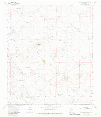
1963 Map of Cow Springs Mountain
USGS Topo · Published 1981About this map
The Continental Divide winds through this high-desert landscape in Luna and Grant Counties, marking a terrain of broad draws and isolated peaks. Water management is the primary signature of human presence here, with a dense network of windmills and tanks such as the Hay Meadow Windmill, Rattlesnake Tank, and Mc Donald Hay Draw Tank supporting the region's ranching economy. The historic Butterfield Trail cuts across the southeast, tracing a path through the flats near Cow Springs Ranch and the base of Cow Springs Mountain. This 1963 survey captures the area at a time when traditional ranching infrastructure, including the Trinity Ranch and namesake Cow Springs, remained the focal points of local geography. The map's detail, including fine fence lines and numerous cattle-watering features like the Thorne Hay Draw Tank, provides a specific record of land use in the New Mexico backcountry.
Find a feature on this map
27 named features on this map. Tap any name to fly to it.
Don’t see what you’re looking for? This feature index may not catch every label — zoom into the map to look around manually.
Map Details
Editions of this 1963 Cow Springs Mountain Map
2 editions found
Other maps of this area

1909 · Silver City
USGS Topo · 1:125,000

1947 · Faywood Station
USGS Topo · 1:24,000

1949 · Whitewater
USGS Topo · 1:24,000

1949 · Faywood Station
USGS Topo · 1:24,000

1950 · White Signal
USGS Topo · 1:24,000

1951 · White Signal
USGS Topo · 1:24,000

1954 · Silver City
USGS Topo · 1:250,000

1958 · Silver City
USGS Topo · 1:250,000

1962 · Silver City
USGS Topo · 1:250,000
1963 · Antelope Hill
USGS Topo · 1:24,000