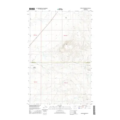
2017 Map of Cowan Reservoir
USGS Topo · Published 2017About this map
Rocky Boy West and Boneau represent the primary centers of settlement on this high plains landscape straddling the line between Hill County and Chouteau County. The terrain is defined by a series of intermittent drainage systems, most notably the winding paths of Big Sandy Creek, Boxelder Creek, and Sage Creek. The local topography is punctuated by the prominent elevation of Square Butte, providing a landmark amidst the broad coulees and draws like Sand Coulee. Water management is central to the area's geography, evidenced by the Cowan Reservoir and Dry Fork Reservoir. A network of local routes, including Route 6, Boneau Road, and Rocky Boy Road, connects these remote reaches, tracing the contours of the land around seasonal flows like Duck Creek and Camp Creek.
Find a feature on this map
31 named features on this map. Tap any name to fly to it.
Don’t see what you’re looking for? This feature index may not catch every label — zoom into the map to look around manually.
Map Details
Editions of this 2017 Cowan Reservoir Map
This is the sole edition of this map. No revisions or reprints were ever made.
Other maps of this area

1904 · Boxelder
USGS Topo · 1:62,500

1906 · Boxelder
USGS Topo · 1:62,500

1919 · Big Sandy
USGS Topo · 1:125,000

1953 · Havre
USGS Topo · 1:250,000

1954 · Shelby
USGS Topo · 1:250,000

1957 · Havre
USGS Topo · 1:250,000

1958 · Shelby
USGS Topo · 1:250,000

1958 · Havre
USGS Topo · 1:250,000

1959 · Laredo
USGS Topo · 1:62,500

1959 · Centennial Mountain
USGS Topo · 1:62,500