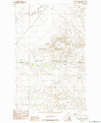
1984 Map of Cowan Reservoir
USGS Topo · Published 1984About this map
The Rocky Boys Indian Reservation dominates the center of this northern Montana landscape, where the terrain shifts from the high, distinctive profile of Square Butte down into a complex network of drainage systems. The survey captures the border region between Hill Co and Chouteau Co, documenting a watershed defined by the winding course of Big Sandy Creek and the seasonal flows of Sand Coulee.
Find a feature on this map
12 named features on this map. Tap any name to fly to it.
Don’t see what you’re looking for? This feature index may not catch every label — zoom into the map to look around manually.
Map Details
Editions of this 1984 Cowan Reservoir Map
This is the sole edition of this map. No revisions or reprints were ever made.
Other maps of this area

1904 · Boxelder
USGS Topo · 1:62,500

1906 · Boxelder
USGS Topo · 1:62,500

1919 · Big Sandy
USGS Topo · 1:125,000

1953 · Havre
USGS Topo · 1:250,000

1954 · Shelby
USGS Topo · 1:250,000

1957 · Havre
USGS Topo · 1:250,000

1958 · Shelby
USGS Topo · 1:250,000

1958 · Havre
USGS Topo · 1:250,000

1959 · Laredo
USGS Topo · 1:62,500

1959 · Centennial Mountain
USGS Topo · 1:62,500