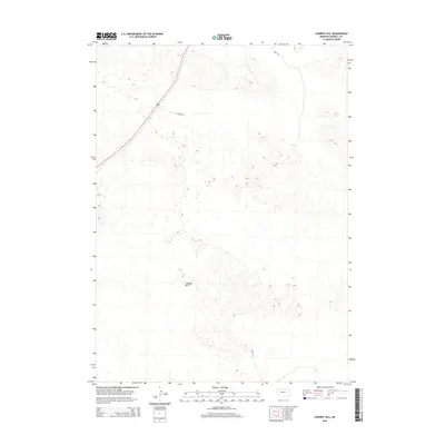
2014 Map of Cowboy Hill
USGS Topo · Published 2014About this map
Cowboy Hill rises as the central topographic feature in this section of western Nebraska, surrounded by a complex network of elevation contours that define the sandhills landscape of Morrill County. The area is characterized by its sparse infrastructure, primarily served by the primary transit corridor of 385, which cuts diagonally through the northwestern quadrant. Local access is facilitated by a small handful of designated routes, including Road 136 and Road 117, which connect the occasional ranching operations or access points within this vast terrain. The 2014 data provided by the U.S. Geological Survey illustrates a region where land use remains dedicated to open space and agriculture, with little in the way of concentrated residential or commercial development beyond the essential road network.
Find a feature on this map
4 named features on this map. Tap any name to fly to it.
Don’t see what you’re looking for? This feature index may not catch every label — zoom into the map to look around manually.
Map Details
Editions of this 2014 Cowboy Hill Map
This is the sole edition of this map. No revisions or reprints were ever made.
Other maps of this area

1896 · Browns Creek
USGS Topo · 1:125,000

1898 · Camp Clarke
USGS Topo · 1:125,000

1899 · Browns Creek
USGS Topo · 1:125,000

1947 · Alliance
USGS Topo · 1:24,000

1947 · Bronco Lake
USGS Topo · 1:24,000

1948 · Hemingford 4 SE
USGS Topo · 1:24,000

1948 · Alliance
USGS Topo · 1:24,000

1949 · Lynn
USGS Topo · 1:62,500
1949 · Bronco Lake
USGS Topo · 1:24,000

1954 · Scottsbluff
USGS Topo · 1:250,000