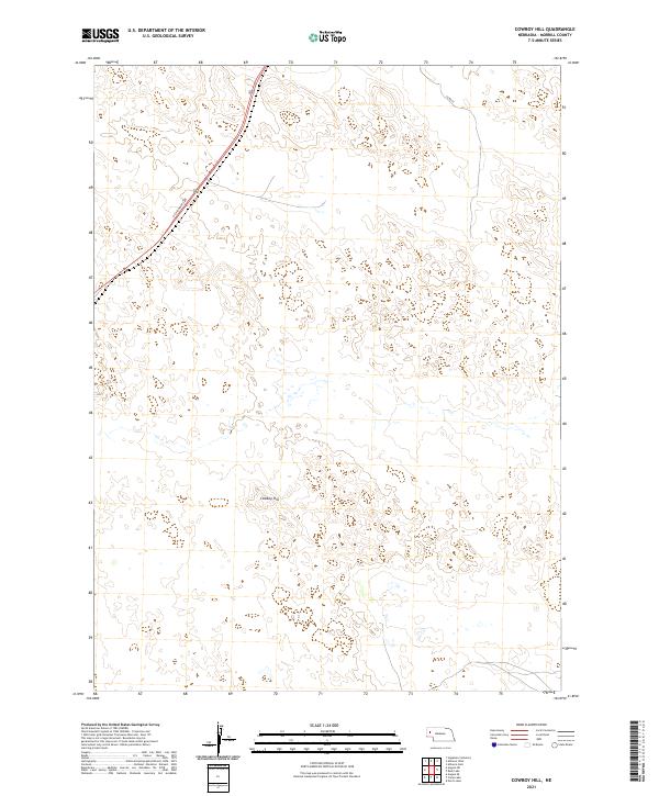
2021 Map of Cowboy Hill
USGS Topo · Published 2021About this map
Cowboy Hill rises as a prominent landmark in this section of the Nebraska Panhandle, situated within the high plains of Morrill County. This area of the state is characterized by expansive range lands and a grid of township boundaries, including t23n r49w and t23n r48w. The primary transportation artery is US Highway 385, which cuts diagonally across the northwestern quadrant, serving as a vital link through the open territory. Local infrastructure is minimal, represented by the presence of Co Rd 62 in the northeast. The map provides a detailed view of the surface hydrology and terrain relief of the sandhills region, where small depressions and scattered wetlands punctuate the land between the low ridges and the namesake hill.
Find a feature on this map
7 named features on this map. Tap any name to fly to it.
Don’t see what you’re looking for? This feature index may not catch every label — zoom into the map to look around manually.
Map Details
Editions of this 2021 Cowboy Hill Map
This is the sole edition of this map. No revisions or reprints were ever made.
Other maps of this area

1896 · Browns Creek
USGS Topo · 1:125,000

1898 · Camp Clarke
USGS Topo · 1:125,000

1899 · Browns Creek
USGS Topo · 1:125,000

1947 · Alliance
USGS Topo · 1:24,000

1947 · Bronco Lake
USGS Topo · 1:24,000

1948 · Hemingford 4 SE
USGS Topo · 1:24,000

1948 · Alliance
USGS Topo · 1:24,000

1949 · Lynn
USGS Topo · 1:62,500
1949 · Bronco Lake
USGS Topo · 1:24,000

1954 · Scottsbluff
USGS Topo · 1:250,000