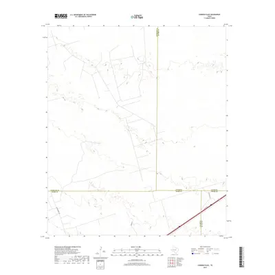
2019 Map of Cowden Place
USGS Topo · Published 2019About this map
The convergence of Winkler, Ector, Ward, and Crane Counties defines this Permian Basin landscape during a period of modern industrial activity. The area is dominated by the geometric patterns of energy infrastructure and oil field access, evidenced by routes like Altura Energy Ltd and Glenn Allen Rd. These roads weave through a high-desert terrain marked by subtle elevation shifts, where traditional transportation corridors such as US Hwy 80 and Park Rd 41 skirt the southern reaches of the quadrangle. This 2019 survey documents a landscape focused on resource extraction, where county boundaries intersect in a sparsely populated expanse of the Texas interior.
Find a feature on this map
9 named features on this map. Tap any name to fly to it.
Don’t see what you’re looking for? This feature index may not catch every label — zoom into the map to look around manually.
Map Details
Editions of this 2019 Cowden Place Map
This is the sole edition of this map. No revisions or reprints were ever made.
Other maps of this area

1954 · Pecos
USGS Topo · 1:250,000

1957 · Pecos
USGS Topo · 1:250,000

1964 · Metz
USGS Topo · 1:24,000

1964 · Red Lakes
USGS Topo · 1:24,000

1964 · Penwell SW
USGS Topo · 1:24,000

1968 · Monahans SE
USGS Topo · 1:24,000

1968 · Cowden Place
USGS Topo · 1:24,000

1968 · China Ranch
USGS Topo · 1:24,000

1969 · Monahans
USGS Topo · 1:24,000
1971 · Amburgey Ranch
USGS Topo · 1:24,000