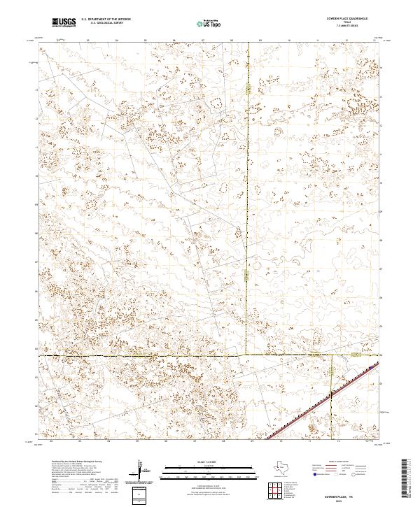
2022 Map of Cowden Place
USGS Topo · Published 2022About this map
The convergence of Winkler, Ector, Ward, and Crane counties defines this West Texas landscape, where energy infrastructure and transportation corridors cut through the desert terrain. Industrial operations are evidenced by the presence of Altura Energy Ltd, while the region's connectivity is maintained through Park Rd 41 and Glenn Allen Rd. The map illustrates a contemporary view of the Permian Basin, showing the intricate network of local roads and county boundaries that organize this oil-producing territory. Large-scale topographic contours reveal the subtle elevations and depressions characteristic of the arid plains in this corner of the state.
Find a feature on this map
8 named features on this map. Tap any name to fly to it.
Don’t see what you’re looking for? This feature index may not catch every label — zoom into the map to look around manually.
Map Details
Editions of this 2022 Cowden Place Map
This is the sole edition of this map. No revisions or reprints were ever made.
Other maps of this area

1954 · Pecos
USGS Topo · 1:250,000

1957 · Pecos
USGS Topo · 1:250,000

1964 · Metz
USGS Topo · 1:24,000

1964 · Red Lakes
USGS Topo · 1:24,000

1964 · Penwell SW
USGS Topo · 1:24,000

1968 · Monahans SE
USGS Topo · 1:24,000

1968 · Cowden Place
USGS Topo · 1:24,000

1968 · China Ranch
USGS Topo · 1:24,000

1969 · Monahans
USGS Topo · 1:24,000
1971 · Amburgey Ranch
USGS Topo · 1:24,000