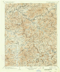
1907 Map of Cowee
USGS Topo · Published 1934About this map
The Little Tennessee River and Tuckasegee River drain a complex mountain landscape where the Southern Ry and its Murphy Branch navigate the high passes. At this time, regional hubs like Franklin, Sylva, and Webster serve as established centers of commerce and governance. The map details the early footprint of the Great Smoky Mountains National Park and the Qualla Indian Reservation, illustrating the intersection of federal land management and indigenous territory.
Find a feature on this map
214 named features on this map. Tap any name to fly to it.
Don’t see what you’re looking for? This feature index may not catch every label — zoom into the map to look around manually.
Map Details
Editions of this 1907 Cowee Map
5 editions found

Other maps of this area

1886 · Knoxville
USGS Topo · 1:125,000

1886 · Dahlonega
USGS Topo · 1:125,000

1886 · Walhalla
USGS Topo · 1:125,000

1888 · Pickens
USGS Topo · 1:125,000

1891 · Cowee
USGS Topo · 1:125,000

1892 · Dahlonega
USGS Topo · 1:125,000

1892 · Walhalla
USGS Topo · 1:125,000

1892 · Knoxville
USGS Topo · 1:125,000

1893 · Mt Guyot
USGS Topo · 1:125,000

1894 · Asheville
USGS Topo · 1:125,000