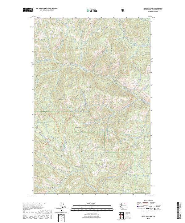
2023 Map of Coxit Mountain
USGS Topo · Published 2023About this map
Salmon Meadows serves as a central landmark within this portion of the Okanogan National Forest, where a network of watercourses and high ridgelines defines the northern Washington interior. The landscape is carved by significant drainages including Sinlahekin Creek, North Fork Salmon Creek, and the multi-branched Coxit Creek. This terrain is characterized by prominent elevations such as Coxit Mtn, Cougar Mtn, and the Twin Peaks, linked by high-altitude crossings like Angel Pass.
Find a feature on this map
48 named features on this map. Tap any name to fly to it.
Don’t see what you’re looking for? This feature index may not catch every label — zoom into the map to look around manually.
Map Details
Editions of this 2023 Coxit Mountain Map
This is the sole edition of this map. No revisions or reprints were ever made.
Other maps of this area

1906 · Chopaka
USGS Topo · 1:125,000

1954 · Okanogan
USGS Topo · 1:250,000

1956 · Loomis
USGS Topo · 1:62,500

1956 · Tiffany Mountain
USGS Topo · 1:62,500

1956 · Horseshoe Basin
USGS Topo · 1:62,500

1957 · Conconully
USGS Topo · 1:62,500

1958 · Okanogan
USGS Topo · 1:250,000
1980 · Blue Goat Mtn
USGS Topo · 1:24,000
1981 · Conconully East
USGS Topo · 1:24,000
1981 · Corral Butte
USGS Topo · 1:24,000