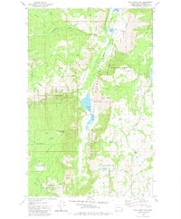
1980 Map of Blue Goat Mtn
USGS Topo · Published 1981About this map
Sinlahekin Wildlife Recreation Area dominates the central valley of this Okanogan County landscape, where the waters of Sinlahekin Creek feed into Blue Lake. The topography is defined by the steep rise of Blue Goat Mountain and the western slopes of Aeneas Mountain, creating a dramatic north-south corridor of riparian habitats and high-elevation peaks. The map details a transition from the rugged highlands of Twin Peaks and Bald Butte to the more developed recreation spots including a Boat Ramp and various smaller basins like Forde Lake and Reflection Pond.
Find a feature on this map
26 named features on this map. Tap any name to fly to it.
Don’t see what you’re looking for? This feature index may not catch every label — zoom into the map to look around manually.
Map Details
Editions of this 1980 Blue Goat Mtn Map
This is the sole edition of this map. No revisions or reprints were ever made.
Other maps of this area

1906 · Chopaka
USGS Topo · 1:125,000

1954 · Okanogan
USGS Topo · 1:250,000

1956 · Loomis
USGS Topo · 1:62,500

1956 · Tiffany Mountain
USGS Topo · 1:62,500

1956 · Horseshoe Basin
USGS Topo · 1:62,500

1957 · Conconully
USGS Topo · 1:62,500

1958 · Okanogan
USGS Topo · 1:250,000
1980 · Aeneas Lake
USGS Topo · 1:24,000
1981 · Conconully East
USGS Topo · 1:24,000
1981 · Riverside
USGS Topo · 1:24,000