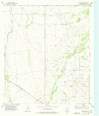
1974 Map of Coyanosa SE
USGS Topo · Published 1977About this map
Coyanosa Draw and Courtney Creek carve through this section of the Permian Basin, defining a landscape shaped by the intensive energy extraction and resource development of the 1970s. The map reveals the infrastructure of a mid-century oil and gas boom, characterized by a dense network of Gas Wells and pipelines that intersect the arid terrain. Central to this industrial activity is the Gas Plant, supported by a Substa and numerous Gravel Pits used for road building and well pad construction. While the surface remains largely undeveloped ranch land, the subsurface economy is clearly established through these industrial markers. Geologists and local historians can trace the early footprint of regional energy corridors, alongside older hydrological features like Wells that suggest the enduring importance of water in this high-desert environment of Pecos County.
Find a feature on this map
11 named features on this map. Tap any name to fly to it.
Don’t see what you’re looking for? This feature index may not catch every label — zoom into the map to look around manually.
Map Details
Editions of this 1974 Coyanosa SE Map
This is the sole edition of this map. No revisions or reprints were ever made.
Other maps of this area

1921 · Fort Stockton
USGS Topo · 1:62,500

1923 · Fort Stockton
USGS Topo · 1:62,500

1928 · Comanche Spring
USGS Topo · 1:125,000

1929 · Hovey
USGS Topo · 1:125,000

1931 · Barstow
USGS Topo · 1:125,000

1954 · Pecos
USGS Topo · 1:250,000

1954 · Fort Stockton
USGS Topo · 1:250,000

1957 · Pecos
USGS Topo · 1:250,000

1958 · Fort Stockton
USGS Topo · 1:250,000

1970 · Fort Stockton West
USGS Topo · 1:24,000