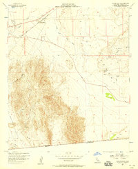
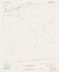
1957 Map of Coyote Wells
USGS Topo · Published 1958About this map
The arid expanses of the southern Colorado Desert are documented in this 1957 survey, where the San Diego and Arizona Eastern railroad tracks parallel the Yuha Cutoff near the international border. The small settlements of Ocotillo and Coyote Wells serve as focal points along the northern edge of the sheet, while the southern boundary follows the United States Mexico line where California Baja California meet.
Find a feature on this map
23 named features on this map. Tap any name to fly to it.
Don’t see what you’re looking for? This feature index may not catch every label — zoom into the map to look around manually.
Map Details
Editions of this 1957 Coyote Wells Map
6 editions found
Other maps of this area

1915 · El Centro
USGS Topo · 1:125,000

1931 · Carrizo
USGS Topo · 1:125,000

1939 · Jacumba
USGS Topo · 1:62,500

1940 · Plaster City
USGS Topo · 1:62,500

1940 · Coyote Wells
USGS Topo · 1:62,500

1942 · El Centro
USGS Topo · 1:250,000

1942 · Carrizo Mtn
USGS Topo · 1:62,500

1942 · Jacumba
USGS Topo · 1:62,500

1943 · Coyote Wells
USGS Topo · 1:62,500

1944 · Plaster City
USGS Topo · 1:62,500