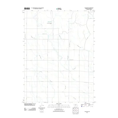
2011 Map of Cozad NW
USGS Topo · Published 2011About this map
Agricultural water management and rural landmarks define this portion of Dawson County north of the Platte River. The landscape is a network of irrigation and flood control engineering, dominated by the Cozad Canal and the Gothenburg Canal which slice diagonally through the township grid. In the northern reaches, the Spring Creek Reservoir 9-A and its accompanying Floodwater Retarding Dam 9-A manage the flow of Spring Creek, illustrating the sophisticated watershed management essential to Nebraska farming. Genealogy researchers will find Cottonwood Cemetery centrally located along Road 766, a vital landmark for local family histories. The map also meticulously documents the numbering system of the lateral ditches, such as Lateral Number 20 and Lateral Number 13, which branch off the primary canals to support the surrounding fields.
Find a feature on this map
28 named features on this map. Tap any name to fly to it.
Don’t see what you’re looking for? This feature index may not catch every label — zoom into the map to look around manually.
Map Details
Editions of this 2011 Cozad NW Map
This is the sole edition of this map. No revisions or reprints were ever made.
Other maps of this area

1896 · Lexington
USGS Topo · 1:125,000

1899 · Lexington
USGS Topo · 1:125,000

1902 · Gothenburg
USGS Topo · 1:125,000

1951 · Oconto SW
USGS Topo · 1:24,000

1951 · Oconto SE
USGS Topo · 1:24,000

1954 · McCook
USGS Topo · 1:250,000

1954 · North Platte
USGS Topo · 1:250,000

1955 · Broken Bow
USGS Topo · 1:250,000

1955 · Grand Island
USGS Topo · 1:250,000

1956 · Broken Bow
USGS Topo · 1:250,000