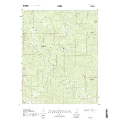
2020 Map of Cozahome
USGS Topo · Published 2020About this map
Buffalo National River snakes through the center of this Ozark landscape, carving a deep valley through the limestone terrain of Marion and Searcy counties. The map captures the river's dynamic character, identifying specific navigational landmarks such as Petits Chute, Dog Leg Chute, and Silver Hollow Shoal. This river corridor serves as the primary orientation point for the surrounding hollows and ridges, which are connected by a network of secondary roads and trails like the Buffalo River Trail and the Indian Rockhouse Trail.
Find a feature on this map
102 named features on this map. Tap any name to fly to it.
Don’t see what you’re looking for? This feature index may not catch every label — zoom into the map to look around manually.
Map Details
Editions of this 2020 Cozahome Map
This is the sole edition of this map. No revisions or reprints were ever made.
Other maps of this area

1890 · Mountain Home
USGS Topo · 1:125,000

1891 · Mountain Home
USGS Topo · 1:125,000

1892 · Marshall
USGS Topo · 1:125,000

1892 · Mountain View
USGS Topo · 1:125,000

1893 · Yellville
USGS Topo · 1:125,000

1894 · Mountain View
USGS Topo · 1:125,000

1894 · Mountain Home
USGS Topo · 1:125,000

1894 · Marshall
USGS Topo · 1:125,000

1901 · Marshall
USGS Topo · 1:125,000

1903 · Yellville
USGS Topo · 1:125,000