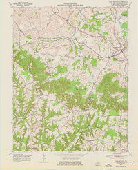
1952 Map of Crab Orchard
USGS Topo · Published 1976About this map
William Whitley House State Shrine stands as a prominent landmark on this 1952 survey of Lincoln County, situated near the historical path of the Wilderness Trail. The landscape is a complex network of ridges and creek valleys, where small agrarian communities like Ottenheim and Broughtentown developed around central institutions such as the Ottenheim Sch and St Sylvester Ch. The northeastern portion of the map is anchored by Crab Orchard, a significant settlement positioned along the Louisville and Nashville railroad line and the Dix River. Numerous family-named burial sites, including the Boone Cem, Pleasant Cem, and Tucker Cem, are scattered throughout the countryside, offering valuable data points for genealogists tracing early Kentucky settlers in the region surrounding Walnut Flat.
Find a feature on this map
47 named features on this map. Tap any name to fly to it.
Don’t see what you’re looking for? This feature index may not catch every label — zoom into the map to look around manually.
Map Details
Editions of this 1952 Crab Orchard Map
2 editions found
Other maps of this area

1892 · Richmond
USGS Topo · 1:125,000

1893 · London
USGS Topo · 1:125,000

1897 · Richmond
USGS Topo · 1:125,000

1897 · London
USGS Topo · 1:125,000

1905 · Harrodsburg
USGS Topo · 1:125,000

1952 · Halls Gap
USGS Topo · 1:24,000

1952 · Eubank
USGS Topo · 1:24,000

1952 · Crab Orchard
USGS Topo · 1:24,000

1952 · Paint Lick
USGS Topo · 1:24,000

1952 · Lancaster
USGS Topo · 1:24,000