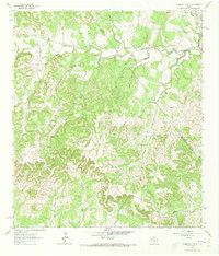
1963 Map of Crabapple Creek
USGS Topo · Published 1973About this map
The Blanco River and its southern fork wind through the limestone-carved terrain of the Texas Hill Country in this early 1960s survey. The landscape is defined by its deep drainages, including the aptly named Sleepy Hollow and Barker Hollow, which feed into Crabapple Creek and the Little Blanco River. Human settlement is centered around small gathering points and agricultural hubs such as the Lindendale Community Hall in the northwest and Kendalia to the southeast. The area reflects a rural economy shaped by both water and stone, evidenced by a Gravel Pit near the river and the tight cluster of buildings at Flugrath. Numerous springs and seasonal creeks like Manahan Creek and Rawls Creek punctuate the wooded draws, illustrating the critical role of surface water in these ranching uplands.
Find a feature on this map
21 named features on this map. Tap any name to fly to it.
Don’t see what you’re looking for? This feature index may not catch every label — zoom into the map to look around manually.
Map Details
Editions of this 1963 Crabapple Creek Map
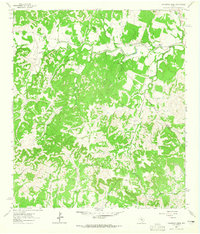
2 editions found
Other maps of this area

1887 · Blanco
USGS Topo · 1:125,000

1894 · Fredericksburg
USGS Topo · 1:125,000

1894 · Blanco
USGS Topo · 1:125,000

1920 · Smithsons Valley
USGS Topo · 1:62,500

1927 · Smithson Valley
USGS Topo · 1:62,500

1929 · Smithson Valley
USGS Topo · 1:62,500

1940 · Smithson Valley
USGS Topo · 1:62,500

1954 · Llano
USGS Topo · 1:250,000

1954 · San Antonio
USGS Topo · 1:250,000

1955 · Llano
USGS Topo · 1:250,000