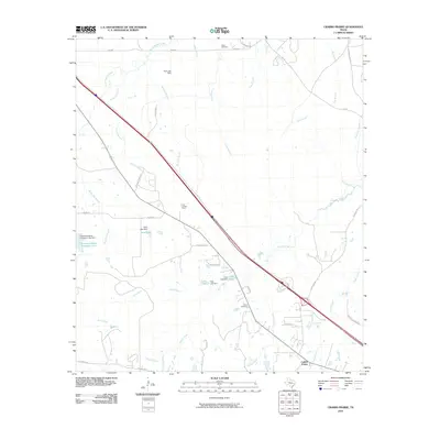
2010 Map of Crabbs Prairie
USGS Topo · Published 2010About this map
Crabbs Prairie sits at the heart of this landscape northwest of Huntsville, where a network of family-named lakes and small drainages defines the local geography. Several agricultural and industrial impoundments, such as Guerrant-Adams Company Lake and Cook Lake, are documented alongside their respective dams. The map provides a clear picture of rural land use and community structure in this part of Walker County, identifying legacy sites like Falba Cemetery, Harmony Cemetery, and Petree Cemetery. The presence of the Fails Lookout Tower near Cedar Ridge points to the area's history of forest management and observation. Numerous branches, including Sulphur Branch and Nelson Creek, weave through the terrain, illustrating the intricate watershed that feeds into South Bedias Creek.
Find a feature on this map
40 named features on this map. Tap any name to fly to it.
Don’t see what you’re looking for? This feature index may not catch every label — zoom into the map to look around manually.
Map Details
Editions of this 2010 Crabbs Prairie Map
This is the sole edition of this map. No revisions or reprints were ever made.
Other maps of this area

1954 · Beaumont
USGS Topo · 1:250,000

1957 · Beaumont
USGS Topo · 1:250,000

1962 · Pine Prairie
USGS Topo · 1:24,000

1962 · Connor
USGS Topo · 1:24,000

1962 · Wyser Bottom
USGS Topo · 1:24,000

1962 · Galilee
USGS Topo · 1:24,000

1962 · Baker Lake
USGS Topo · 1:24,000

1963 · Steep Branch
USGS Topo · 1:24,000

1963 · Crabbs Prairie
USGS Topo · 1:24,000
1963 · Loma
USGS Topo · 1:24,000