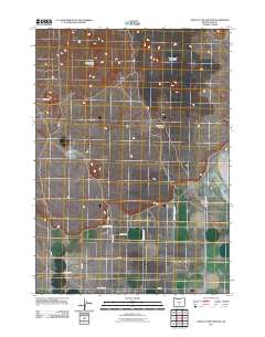
2011 Map of Crack In The Ground
USGS Topo · Published 2011About this map
Crack in the Ground, a volcanic fissure in the high desert, serves as the centerpiece for this Lake County survey. The landscape is defined by its recent geological history, notably the Four Craters Lava Field and the surrounding volcanic buttes like South Green Mountain and Reed Rock. While the northern reaches of the map are dominated by these natural formations, the southern section shows a transition to a more structured grid of rural access roads.
Find a feature on this map
15 named features on this map. Tap any name to fly to it.
Don’t see what you’re looking for? This feature index may not catch every label — zoom into the map to look around manually.
Map Details
Editions of this 2011 Crack In The Ground Map
This is the sole edition of this map. No revisions or reprints were ever made.
Other maps of this area

1955 · Crescent
USGS Topo · 1:250,000

1957 · Crescent
USGS Topo · 1:250,000

1958 · Crescent
USGS Topo · 1:250,000

1970 · Crescent
USGS Topo · 1:250,000

1981 · Hogback Butte
USGS Topo · 1:24,000

1981 · Thorn Lake
USGS Topo · 1:24,000

1981 · Lane Lake
USGS Topo · 1:24,000

1982 · Peters Creek Sink
USGS Topo · 1:24,000

1982 · Christmas Lake
USGS Topo · 1:24,000

1982 · Jacks Place
USGS Topo · 1:24,000