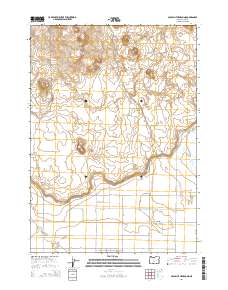
2014 Map of Crack In The Ground
USGS Topo · Published 2014About this map
The Four Craters Lava Field and the volcanic fissure known as Crack in the Ground define this Lake County landscape, where the geology of the Oregon high desert meets a grid of rural residential development. In the southern portion of the quadrangle, the community of Christmas Lake Valley is mapped through a series of evocative road names, including Christmas Tree Rd, N Candy Rd, and Honey Do Ln, reflecting a planned mid-century settlement pattern in a previously isolated volcanic basin. The map reveals the stark contrast between the intricate contours of volcanic terrain like Lava Craters and South Green Mtn and the rigid survey lines of the public land system. To the west, Bowman WLS and Reed Rock punctuate the arid terrain, while local thoroughfares like Raven Ridge Ln and Millican Rd provide the essential transit network for this remote high-desert interior.
Find a feature on this map
30 named features on this map. Tap any name to fly to it.
Don’t see what you’re looking for? This feature index may not catch every label — zoom into the map to look around manually.
Map Details
Editions of this 2014 Crack In The Ground Map
This is the sole edition of this map. No revisions or reprints were ever made.
Other maps of this area

1955 · Crescent
USGS Topo · 1:250,000

1957 · Crescent
USGS Topo · 1:250,000

1958 · Crescent
USGS Topo · 1:250,000

1970 · Crescent
USGS Topo · 1:250,000

1981 · Hogback Butte
USGS Topo · 1:24,000

1981 · Thorn Lake
USGS Topo · 1:24,000

1981 · Lane Lake
USGS Topo · 1:24,000

1982 · Peters Creek Sink
USGS Topo · 1:24,000

1982 · Christmas Lake
USGS Topo · 1:24,000

1982 · Jacks Place
USGS Topo · 1:24,000