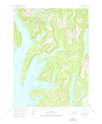
1951 Map of Craig A-2
USGS Topo · Published 1974About this map
The industrial frontier of Prince of Wales Island is clearly visible in this early 1950s survey, marked by specialized extraction infrastructure in the north. The presence of the Jumbo Mine and its connecting Aerial Tram descending into Jumbo Basin reveals the logistical challenges of high-altitude mining near Copper Mtn. Coastal settlements like Copper City and Hetta appear as vital shoreline nodes, serving as the primary gateways between the rugged interior mountains and the labyrinth of navigable waterways like Hetta Inlet and Nutkwa Inlet.
Find a feature on this map
43 named features on this map. Tap any name to fly to it.
Don’t see what you’re looking for? This feature index may not catch every label — zoom into the map to look around manually.
Map Details
Editions of this 1951 Craig A-2 Map
3 editions found

Other maps of this area

1948 · Dixon Entrance D-2
USGS Topo · 1:63,360

1948 · Craig A-1
USGS Topo · 1:63,360

1948 · Dixon Entrance D-1
USGS Topo · 1:63,360

1948 · Dixon Entrance D-3
USGS Topo · 1:63,360

1948 · Craig A-3
USGS Topo · 1:63,360

1948 · Craig A-2
USGS Topo · 1:63,360

1949 · Craig B-2
USGS Topo · 1:63,360

1949 · Craig B-3
USGS Topo · 1:63,360

1949 · Craig B-1
USGS Topo · 1:63,360

1950 · Craig B-1
USGS Topo · 1:63,360